GPS apps have become our go-to sidekicks, whether we're hitting the open road or navigating through mountain trails. Today, we're diving into the best GPS apps for iPhone that combine top-notch navigation with innovative features. We’ve evaluated each app for its offline maps, data storage, update frequency, and user interface. These are the apps you can trust to get you to your destination, whether you're road-tripping or exploring uncharted territories.
To make the most out of these apps, pair them with wireless CarPlay. Imagine a seamless connection with your GPS on a bigger screen, all wire-free! In this post, we’re going to take a deep dive into each navigation app. Whether you’re searching for a GPS app for iPhone or GPS apps for safer travels, we’re here to help.
So without further ado, let’s hit the road or trails together!
TL;DR
Google Maps offers the most comprehensive real-time data and POI database
Apple Maps provides seamless iOS integration and privacy-focused features
Gaia GPS is ideal for outdoor enthusiasts with detailed topographic maps
Here WeGo excels in offline functionality and public transit information
OsmAnd Maps offers highly customizable open-source maps
Guru Maps provides detailed offline maps with multi-language support
Avenza Maps allows importing of specialized maps and GPS tracking
Pocket Earth Maps has extensive offline capabilities and travel guides
AllTrails is best for hikers with its extensive trail database and reviews
Comparison Table

Criteria Breakdown Summary
Alright, here’s the lowdown on what makes the best GPS app for the iPhone. First, offline functionality is key. Inevitably, you want maps available even when you’re out of cell range. Then, there’s map quality and detail: crisp visuals and accuracy are game-changers. A solid user interface is non-negotiable; it should be easy to use, especially when you’re on the go. Next are extra features like real-time traffic or voice guidance. Efficiency matters too – no one wants their battery drained mid-trip. And finally, when it comes to mapping apps, prices can range from free to premium options, so it’s all about what works for you.
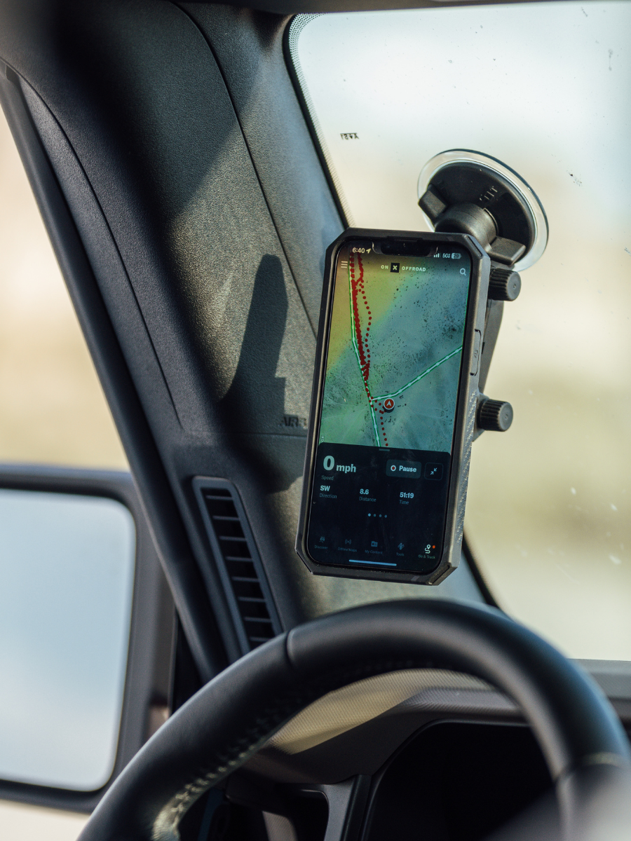
And hey, when you’re out there on the open road, think about where your phone is mounted for easy access. Check out this guide on the best places to mount a car phone holder to make sure your setup’s road-ready!
1. Google Maps
Best Known for Comprehensive Real-Time Data

Features
Google Maps is known for features like these:
Real-time traffic updates that adjust your route based on live conditions.
Offline maps for those no-signal zones – download and go!
Street View with 360-degree imagery to get a feel for any location.
Integrated business info and reviews, perfect for finding your next pit stop.
Public transit schedules for seamless commuting across town or new cities.
Crowdsourced data keeps traffic insights fresh.
Smooth vector-based maps use less storage, perfect for offline maps.
Satellite and street-level imagery offer incredible on-the-ground detail.
Pros
Extensive and accurate POI database
Regular updates with new features and improved data
Intuitive user interface
Robust search functionality
Cons
Requires internet connection for full functionality
Can be battery-intensive during prolonged use
Privacy concerns due to data collection practices
Criteria Evaluation
- Offline functionality: 4/5
Map quality and detail: 5/5
User interface: 4.5/5
Additional features: 5/5
Battery consumption: 3.5/5
Community Reviews and Expert Recommendations
Price
Google Maps is available on the App Store for free.
2. Apple Maps
Best Known for Native iOS Integration
When it comes to map apps, Apple Maps is like your iPhone's best friend in navigation. Apple built this map app from the ground up with iOS in mind. This means it’s going to run smooth like butter for iPhone users. They’ve seriously boosted their map detail and accuracy in recent years, adding detailed city views and handy indoor mapping. Plus, Apple prioritizes privacy, using on-device intelligence for personalized navigation.
Here’s how Apple Maps does things:
Apple Maps taps into Apple’s own mapping data for precision and detail, getting better with every update.
Privacy is huge here, with data staying local to your device for all those customized location recommendations.
In select cities, Apple Maps even throws in augmented reality directions through ARKit, turning your screen into a next-gen GPS that gives you a feel for exactly where to turn.
Whether you're navigating a new city or using AR walking directions, Apple Maps is a solid, iPhone-optimized pick for reliable navigation.

Features
- Apple Maps comes with features like:
3D city views with detailed landmarks that look amazing on the iPhone
Indoor maps for airports and shopping centers to navigate like a pro
Siri integration for hands-free, seamless navigation
Look Around feature gives a street-level view that’s crisp and clear
Real-time transit info so you’re always in the know
Uses a custom vector engine for smooth map transitions and rendering
Syncs with Apple’s ecosystem for perks like automatic calendar event locations
Privacy-focused, so your location stays your business
Pros
Seamless integration with iOS devices
Privacy-focused approach to navigation
Clean, intuitive interface
Improving map accuracy and coverage
Cons
Less detailed than some competitors in certain areas
Fewer user-contributed data points compared to Google Maps
Limited functionality on non-Apple devices
Criteria Evaluation
- Offline functionality: 3.5/5
Map quality and detail: 4/5
User interface: 4.5/5
Additional features: 4/5
Battery consumption: 4/5
Community Reviews and Expert Recommendations
Apple Maps has come a long way, and users really dig the clean interface and focus on privacy. Many say they’ve noticed way better accuracy and coverage over the years, especially with features that make it easy to jump from your iPhone to an Apple Watch or use Siri hands-free. Experts often point it out for folks who prioritize iOS integration, but some users still prefer Google Maps for its larger point-of-interest database.
Apple’s map data overhaul has had a clear impact on user satisfaction, especially for those looking to keep their data private. Compared to other map apps, Apple’s location handling is privacy-centered, with most processing done on-device. And if you’re deep in Apple’s ecosystem, integration perks like Siri and Apple Watch make it feel like a natural extension of your setup.
Price
3. Gaia GPS
Best Known for Outdoor Navigation

Features
When it comes to GPS apps, Gaia GPS is notable for features like these:
Offline topographic maps for remote access
Trail tracking and recording for easy retracing
Weather forecast overlays to keep you prepared
Custom map creation and sharing for unique adventures
Integration with external GPS devices for enhanced accuracy
Uses vector maps for efficient offline storage and quick rendering
Barometric altimeter support for better elevation accuracy
API integration lets third-party developers sync data and connect to apps
Pros
Excellent for hikers and outdoor enthusiasts
Detailed topographic maps and trail information
Robust offline functionality
Active community for trail reports and updates
Cons
Steeper learning curve than some general navigation apps
Premium features require a subscription
Can be battery-intensive during extended use
Criteria Evaluation
- Offline functionality: 5/5
Map quality and detail: 4.5/5
User interface: 4/5
Additional features: 4.5/5
Battery consumption: 3.5/5
Community Reviews and Expert Recommendations
Price
When looking at outdoor-sy GPS apps for iPhone, you can definitely download Gaia GPS for free. However, those premium features come with a subscription (starting at $4.99 -$7.49 per month, depending on the plan). It’s available on the App Store.
4. Here WeGo
Best Known for Comprehensive Route Options

Features
For a navigation app, here’s what you can expect with Here WeGo:
Offline maps for over 100 countries—perfect for staying on track without data
Public transit info in 1,300+ cities, giving you options when you’re in unknown territory
Turn-by-turn voice navigation to keep you hands-free
Parking finder features, so you’re not circling endlessly
Speed limit alerts to keep your drive safe
Uses OpenStreetMap and HERE’s own data for accuracy
Leverages predictive traffic modeling for smarter routes
Developer tools for app integration with SDK and API options
Pros
Excellent offline functionality
Comprehensive public transit information
User-friendly interface
Regular map updates
Cons
Less detailed POI database compared to Google Maps
Limited community-contributed content
Some features may require an internet connection
Criteria Evaluation
- Offline functionality: 4.5/5
Map quality and detail: 4/5
User interface: 3.5/5
Additional features: 4/5
Battery consumption: 4/5
Community Reviews and Expert Recommendations
Price
You can find Here WeGo on the App Store free.
5. OsmAnd Maps
Best Known for Open-Source Customization

Features
GPS apps like OsmAnd have features that keep you covered whether you’re off-road or offline such as:
Highly customizable map display options
Offline navigation and search—perfect for no-signal zones
Rich topographic details for outdoor adventuring
GPS tracking and trip recording for activity logging
Compatibility with external GPS devices for extended precision
Direct access to raw OpenStreetMap data for pros and devs
Efficient vector rendering tech for smooth map interaction
Plugin support for adding just the features you want
Pros
Extensive customization options
Privacy-focused with minimal data collection
Regular updates from OpenStreetMap community
Rich feature set for outdoor activities
Cons
Steeper learning curve due to complexity
Interface can be less intuitive for casual users
Some features require in-app purchases
Criteria Evaluation
- Offline functionality: 5/5
Map quality and detail: 4/5
User interface: 3/5
Additional features: 4.5/5
Battery consumption: 4/5
Community Reviews and Expert Recommendations
Price
So, OsmAnd Maps is free to download on the App Store with some in-app purchases for extra features. These add-ons and monthly subscriptions range anywhere from $1.99-$29.99 but they give you options to really deck out your offline mapping.
6. Guru Maps
Best Known for Detailed Offline Maps
If you’re looking for GPS apps that really deliver when it comes to offline capability, Guru Maps is hard to beat. It’s known for packing in detailed topographic data and ultra-smooth rendering, making it perfect for off-the-grid adventures. It’s a solid pick for anyone who needs reliable maps without the need for constant connectivity.

Features
When it comes to an ultimate navigation app, here’s what you get with Guru Maps:
Detailed offline topographic maps for unconnected travel
GPS track recording with sharing capabilities for fellow adventurers
Custom waypoint creation for marking important stops
Multi-language support, handy for international travel
Integrated travel guides to enrich exploration of select locations
Supports custom map sources and overlays for personalized navigation
Efficient GPS tracking algorithms for precise path logging
API availability for seamless integration and data sharing with other apps
Pros
Excellent offline map quality
Support for multiple languages
Robust trip recording capabilities
Regular map updates
Cons
Interface may be less intuitive for some users
Limited POI database compared to larger competitors
Some advanced features require in-app purchases
Criteria Evaluation
- Offline functionality: 4.5/5
Map quality and detail: 4/5
User interface: 3.5/5
Additional features: 3.5/5
Battery consumption: 4/5
Community Reviews and Expert Recommendations
Price
For GPS apps for iPhone, Guru Maps gives you the basic app for free on the App Store. However, if you’re serious about the Pro features, you’ve got some options with subscriptions and one-time purchases ranging from $2.49 - $67.00, depending on what you’re searching for.
7. Avenza Maps
Best Known for Specialized Map Importing

Features
Avenza Maps is among mapping apps that’s packed with features like:
Import georeferenced PDF maps for specialized navigation
GPS tracking that works without cell service
Tools to measure distances and areas on any map
Add your own placemarks and photos for better customization
Explore a broad selection of pro maps in the Avenza Map Store
SDK access for building custom map applications
Smooth vector-based rendering for easy map interaction
Cloud sync for all your map data and any content you add
Pros
Support for specialized and custom maps
Functions without cellular data or internet
Accurate GPS tracking on imported maps
Wide selection of maps in the Avenza Map Store
Cons
Limited navigation features compared to traditional GPS apps
Some maps require purchase
Learning curve for importing and using custom maps
Criteria Evaluation
- Offline functionality: 5/5
Map quality and detail: 4.5/5
User interface: 3.5/5
Additional features: 4/5
Battery consumption: 4/5
Community Reviews and Expert Recommendations
Price
8. Pocket Earth Maps
Best Known for Comprehensive Offline Capabilities

Features
When it comes to GPS apps for navigation, Pocket Earth is your travel guide with features like:
Comprehensive offline maps that cover entire countries and regions
Built-in travel guides and loads of points of interest
Search and route planning that works offline
Custom waypoints you can create and share with friends
Compatibility with external GPS devices for extra precision
Pulls map data from sources like OpenStreetMap for accuracy and detail
Uses efficient routing for smooth offline navigation
Offers an API for seamless third-party app integration and data sharing
Pros
Extensive offline mapping capabilities
Integrated travel information and guides
Regular map updates
Efficient storage of large map areas
Cons
Less frequent app updates compared to some competitors
Limited community-contributed content
Some users find the interface dated
Criteria Evaluation
- Offline functionality: 5/5
Map quality and detail: 4/5
User interface: 3.5/5
Additional features: 4/5
Battery consumption: 4.5/5
Community Reviews and Expert Recommendations
Price
Those searching for just the right GPS apps for iPhone may find it with Pocket Earth Maps. The App Store offers a free download with the essential maps. However, the in-app purchases give way to more specific regions and topographic options. These range anywhere from $1.99 - $9.99.
9. AllTrails
Best Known for Extensive Trail Database
AllTrails is like your ultimate adventure buddy if you’re into hiking, trail running, or exploring the outdoors. It’s packed with user-generated data on thousands of trails, complete with photos, reviews, and detailed route info. You’ve got GPS tracking for your trek, so you can record your path, share it, or even sync it up with your fitness tracker. Whether you’re after the best hidden paths or just want a solid navigation app for the wild, this one’s geared for serious outdoor enthusiasts.

Features
For those who love all things nature, All Trails is your go-to as one of the best navigation apps with features like these:
Massive database of hiking, biking, and running trails
User-generated reviews and photos for extra trail insights
GPS tracking with route recording to document your adventure
Offline maps available with a subscription for those off-grid days
Integrates with Apple Health and other fitness apps
API access for third-party developers to leverage AllTrails data
Uses machine learning for personalized trail recommendations
3D map visuals for better terrain and elevation awareness
Pros
Comprehensive trail database
Active community providing up-to-date trail information
User-friendly interface
Integration with fitness tracking apps
Cons
Full offline functionality requires a paid subscription
Limited navigation features for urban areas
Some users report occasional GPS accuracy issues
Criteria Evaluation
- Offline functionality: 4/5
Map quality and detail: 4.5/5
User interface: 4.5/5
Additional features: 4.5/5
Battery consumption: 3.5/5
Community Reviews and Expert Recommendations
Price
When it comes to GPS apps for iPhone, AllTrails comes with a free version available on the App Store with in-app purchases. You get all the basics this way. If you want the full monty though, there’s AllTrails+ and it costs $35.99.
Notable Mentions
Spyglass
Spyglass is a navigation app that’s perfect for off-the-grid adventurers. It combines augmented reality with precise navigation tools like gyrocompass, altimeter, and rangefinder. Whether you're navigating the backcountry or just need a reliable compass in your pocket, this one’s got you covered. Plus, it’s all accessible right on the App Store.
MapFactor
When it comes to the best navigation apps, MapFactor should be on your radar if you’re a fan of offline navigation. This app uses OpenStreetMap data to bring detailed, offline maps to your iPhone, covering routes for cars, trucks, and even bicycles. It’s straightforward with no frills—just solid navigation and real-time traffic data if you’re online. With features like voice-guided turn-by-turn navigation and adjustable routing preferences, MapFactor is a no-nonsense choice, especially for those venturing into areas without reliable cell coverage. Find it on the App Store.
Waze
When it comes to the best GPS apps for iPhone, no list, even notables, would be complete without mentioning Waze. This GPS app is crowd-sourced navigation at its finest. Users report real-time road conditions, from speed traps to potholes, so you can dodge traffic and get the heads-up on what’s ahead. Plus, Waze’s quirky voice options and ETA-sharing features keep things interesting on the road. Whether you’re commuting or road-tripping, Waze has become a staple for its ability to shave precious minutes off your drive. Available on the App Store, it’s a classic for a reason.
FAQ
Which GPS app is best for offline use?
What's the most accurate GPS app for iPhone?
Are there any free GPS apps that don't require an internet connection?
How do GPS apps impact iPhone battery life?
Can I use my iPhone as a handheld GPS device for hiking?
Final Thoughts
Top 9 GPS Apps for iPhone in 2025: Navigate with Confidence
It’s a big world out there. So whether you’re trekking remote trails or navigating those city streets, you need GPS apps for iPhone that have your back. Offline functionality tends to be a must these days. Especially when we’re out experiencing all the great outdoors has to offer (we tend to lose service, inevitably).
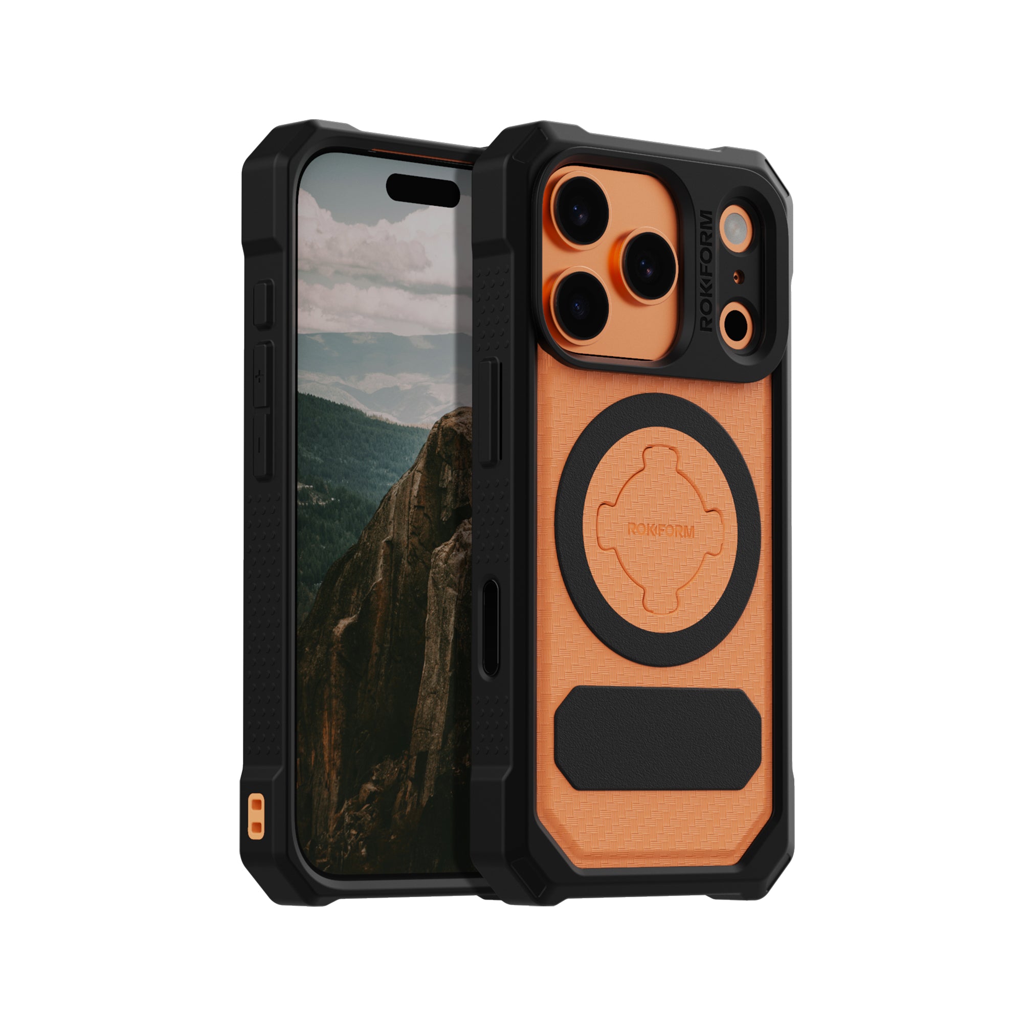
Apps are stepping up with machine learning for route optimization and AR for enhanced real-world navigation. But all that tech doesn’t mean a thing if your phone isn’t protected. That’s where we at Rokform come in. Our rugged phone cases and mounting systems keep your device secure, wherever your adventures lead.
And if you’re hitting the road?
Download the best GPS app for iPhone that suits your style, and pair it with Rokform’s military-grade protection. From the daily commuter to the hardcore hiker, a reliable GPS app and rugged protection from our Best iPhone 16 Pro Max Cases will make sure you’re covered, no matter where you roam.

