


Rokform Super Grip Vent Mount: $19.99, no adhesive.
18 Pacific Coast Highway stops with verified 2026 access, plus the Bixby Bridge parking ban nobody has covered yet.
Highway 1 through Big Sur reopened on January 14, 2026, ending roughly three years of landslide closures. That is the story every other article is telling.
Here is the rest of it. The road closed again on February 17 for slide debris. A wildfire shut a 10-mile section from August 11 to August 22. Four Big Sur state parks are still closed. You can no longer park at Bixby Bridge. And gas at Gorda hit $9.99 a gallon.
Highway 1 is open as of the last Caltrans check. It is also the most crowded, most restricted, most expensive version of this drive in living memory. Officials cited a 900% year over year increase in northbound traffic at Ragged Point after the reopening.
So this is not a list of pretty places. It is 18 stops sorted by whether you can actually get to them right now, what it costs, and what will stop you.
Table of Contents
- Highway 1 Status, Verified
- What Pacific Coast Highway Actually Means
- The Stops That Are Fully Open
- The Stops With A Catch
- The Stops That Are Closed Right Now
- Fuel, Signal And The Things That Strand People
- When To Actually Go
- What Rokform Is Bringing To This In September
- Final Thoughts
TL;DR
- Highway 1 is open end to end through Big Sur, with 24/7 one-way signal control at Rocky Creek Bridge, post mile 60.0.
- New for 2026: a 12-month no-parking zone at Bixby Bridge, 900 feet north and 700 feet south, effective early August.
- Four Big Sur state parks are closed from the Timber Fire, including Julia Pfeiffer Burns, home of McWay Falls.
- Drive north to south. The pullouts are on the ocean side, so southbound you turn right instead of crossing traffic.
- Gorda is the only fuel on the remote stretch and it runs near $10 a gallon. Fill up in Carmel or Cambria.
- Assume no cell service through Big Sur on any carrier. Download offline maps before Carmel.
Highway 1 Status, Verified
Road status on this route changes faster than articles get updated, so here is the check, dated.
Verified against the Caltrans road information feed, Saturday August 22, 2026, 10:29 PM: no closure listed on State Route 1 in Monterey County. San Luis Obispo County clear. Southern California clear.
The one restriction that will affect you: Rocky Creek Bridge, post mile 60.0, 15.7 miles south of Monterey, one-way traffic under automated signal control, 24 hours a day. A slip-out on March 30, 2024 undermined the southbound lane. Temporary signals went live May 29, 2026 while a permanent viaduct is built, funded at $20 to $30 million.
Important correction to older coverage: this is a traffic signal, not a pilot-car convoy. Several articles still describe convoy operations with departure windows from the 2024 closure. That is obsolete. You wait at a light.

Additional one-way controls in the corridor, all long term, all with delays of roughly 10 to 15 minutes: Point Sur Lighthouse area, the Ventana to Nepenthe stretch from 7 AM to 5 PM, and the Big Sur Creek area weekdays 6 AM to 4 PM through early September.
At the Los Angeles end, PCH is an active reconstruction zone. Caltrans District 7 has an 8.5-mile work zone between Chautauqua Boulevard and Carbon Beach Terrace from the January 2025 Palisades Fire, with speeds dropped to 25 to 35 mph and possible single-lane closures weekdays 9 AM to 3 PM. No completion date has been published. Budget an extra hour for the final run into LA.
The Named Slides, And Which Ones Still Matter
| Slide | Location | Status now |
|---|---|---|
| Regent's Slide | Between Lucia and Gorda | Reopened January 14, 2026, about 90 days early |
| Rocky Creek | Post mile 60.0 | Open, 24/7 one-way signal control |
| Paul's Slide | North of Lucia | Open, no current restriction |
| Mud Creek | Near Gorda | Open since July 2018 |
No new slide has closed the highway since Regent's reopened. The only 2026 closure was the fire.
One caution worth stating plainly. After the August reopening, CAL FIRE's own incident page, an AP wire story, and the California State Parks site all still displayed closure text for a road that was open. Check roads.dot.ca.gov or Caltrans QuickMap the morning you drive. Caltrans is the authority. Everything else lags.
What Pacific Coast Highway Actually Means
Three different trips share this name, and conflating them is why mileage figures never match.
California State Route 1 is 656 miles, from Interstate 5 near Dana Point to US 101 near Leggett. It is not one unbroken ribbon. US 101 breaks it into five pieces, and stretches through Dana Point, Newport Beach, Santa Monica and Oxnard have been handed to local control. The name "Pacific Coast Highway" is official only from Dana Point to Oxnard. North of that it is the Cabrillo Highway, then the Shoreline Highway.
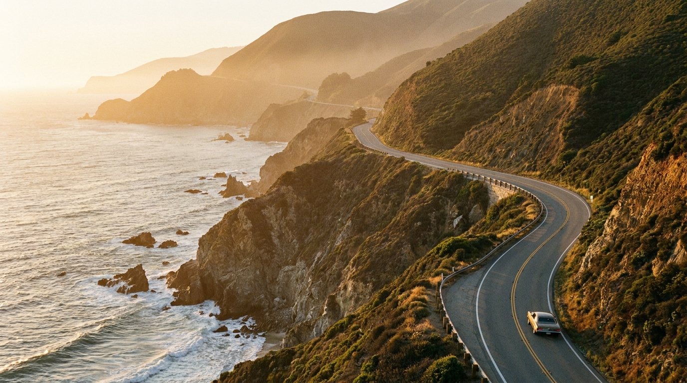
The Big Sur Coast Highway is 71.2 miles, Malpaso Creek near Carmel Highlands to San Carpóforo Creek. Built 1919 to 1937, 29 bridges, All-American Road since 1996. This is the part people mean when they say the drive changed their life.
The trip most people are actually planning runs Washington or Oregon to San Diego, about 1,650 miles and close to 40 hours of driving. The Oregon and Washington portions are US 101, not Highway 1. Allow 10 to 14 days for the full run, or 6 days minimum for San Francisco to San Diego.

Drive It North To South, And Here Is The Actual Reason
The recommendation is nearly unanimous and it has nothing to do with light or scenery.
Southbound puts you in the right lane, on the ocean side of the road. Every pullout, every vista point, every informal shoulder is on that side. Southbound you slow down and turn right. Northbound, every single stop requires a left turn across oncoming traffic on a two-lane road with blind curves and no turning lane.
The consequence people underestimate: you will stop more often, because stopping is easy instead of a decision you keep deferring. That matters more here than on other scenic drives, because the entire 71.2-mile Big Sur stretch has only three paved roadside vista points.
The only argument for northbound is logistical. You live in LA, or the one-way rental drop fee favors it.
Segment Times, San Francisco To Los Angeles
Approximate. Caltrans publishes post miles, not touring distances.
| Segment | Miles | Driving time |
|---|---|---|
| San Francisco to Santa Cruz | 75 | 1 hr 45 min |
| Santa Cruz to Monterey | 45 | 1 hr |
| Monterey to Carmel | 5 | 15 min |
| Carmel to Big Sur village | 26 | 45 min or more with the signal |
| Big Sur to San Simeon | 65 | 2 hr or more |
| San Simeon to Morro Bay | 40 | 50 min |
| Morro Bay to Pismo Beach | 20 | 30 min |
| Pismo to Santa Barbara | 95 | 1 hr 45 min |
| Santa Barbara to Malibu | 70 | 1 hr 30 min |
| Malibu to Los Angeles | 30 | 1 hr or more, work zone |
| Total | ~470 to 500 | 11 to 12 hours of driving |
Realistically three to five days. Anyone telling you it is a weekend has not driven it since the reopening.
The Stops That Are Fully Open
1. Point Lobos State Natural Reserve, Carmel
Open, $10 per passenger car, no reservation. The catch is a hard 150-vehicle parking cap and it fills. Gates open 8:00 AM, last entry 6:30 PM. Arrive before 9:30 AM or after 3:00 PM.
2. 17-Mile Drive, Pebble Beach
Open, $12.50 per vehicle, no reservation, gates sunrise to sunset. The fee is reimbursed with a $35 or larger purchase at Pebble Beach Resorts restaurants. Motorcycles are prohibited. Free for guests of The Lodge, The Inn at Spanish Bay and Casa Palmero.
3. Monterey Bay Aquarium
Open. Adults 18 to 69, $65. Youth 5 to 17 and seniors 70+, $50. Advance purchase with a timed date and time is recommended. Free for Monterey County residents on scheduled days, and free entry for SNAP and CalFresh holders through Museums for All.

4. Hearst Castle, San Simeon
Open. Grand Rooms, Upstairs Suites, or Cottages and Kitchen tours run $35 adult and $18 child. Designing the Dream is $40 and $23. The Julia Morgan Tour is $110. All include a $5.50 non-refundable registration fee and the "Building the Dream" film.
Advance reservations are strongly recommended, bookable up to 60 days ahead through ReserveCalifornia. Walk-up is subject to availability, which in a 900%-traffic year means plan on booking.

5. Piedras Blancas Elephant Seal Rookery
Free, open, roadside, and no reservation. Between San Simeon and Ragged Point. One of the few genuinely free marquee stops left on this route.
6. Morro Bay And Morro Rock
Open. Note that the Morro Rock Beach lot now enforces paid parking, which is new and catches people who remember it as free.
7. Pismo Beach
Open. Pier and most beach access free. The last easy stop before the route turns inland toward Lompoc.
8. Santa Barbara
Open and unaffected by everything above. City metered parking. This is where a Big Sur day trip becomes a coastal road trip, and where lodging inventory gets deep enough to find a last-minute room.
9. El Matador, La Piedra And El Pescador, Malibu
Open. Verified on the California State Parks site as of August 22, 2026, no closures listed. $10 per vehicle day use, or $3 hourly. Open 8:00 AM to sunset. Blufftop parking is limited and the paths down to the coves are steep.

The Stops With A Catch
10. Bixby Creek Bridge, Where You Can No Longer Park
This is the single most important change on the route in 2026, and almost nothing else has covered it.
Effective early August 2026, parking is banned on the Highway 1 shoulder at Bixby Bridge. Monterey County supervisors approved it 4 to 0 on June 23, signs went up before Monterey Car Week, and it covers 900 feet north and 700 feet south of the bridge, plus Old Coast Road. It runs for 12 months.
The reason is the traffic surge: a 900% year over year increase in northbound traffic at Ragged Point after Highway 1 reopened.
None of the sources I checked named a designated legal alternative. Treat Bixby as a drive-past-and-admire stop for the next year. There are also no toilets within several miles of it.
11. Big Sur Village Businesses
Mostly reopened after the Timber Fire. Nepenthe is back. Post Ranch Inn reopened. Alila Ventana remained evacuated and closed as of August 22. Call ahead rather than assuming, because the fire is still burning at 25% containment and an evacuation warning covers roughly 40 miles from Big Creek Reserve to Andrew Molera.
12. Big Sur Camping, Under New Rules
State park camping is open where the parks are open, at $50 to $60 per night at Pfeiffer Big Sur and $30 at the Andrew Molera and Julia Pfeiffer Burns environmental sites. Firewood is $12 a bundle. Tour buses and RVs are not permitted in the lots at Andrew Molera or Julia Pfeiffer Burns.
New as of July 1, 2026, California State Parks tightened the reservation policy. Full refund only if you cancel seven or more days out. Cancel two to six days out and you forfeit the first night. Cancel within 48 hours or no-show and you forfeit all fees paid. And the one with teeth: three no-shows in a calendar year earns a one-year ban from making reservations. There is an $8.25 cancellation fee.
The upside for you: the policy pushes cancellations back into inventory earlier, so checking ReserveCalifornia at 8:00 AM for released sites is now a materially better tactic than it used to be.

13. The Day-Use Ticket That Covers Multiple Parks
Day use across Big Sur state parks is $10 per vehicle, and the genuinely useful detail nobody prints: that ticket allows access to other California State Parks until closing on the day of purchase. One $10 payment, multiple parks. Seniors 62+ pay $1 less, disabled pass holders $5, and distinguished veterans and Golden Bear pass holders are free.
The Stops That Are Closed Right Now
This is the section that will be wrong first, and the section every competing article is missing entirely.
Four Big Sur state parks are closed due to the Timber Fire, verified on the California State Parks site as recently as August 25, 2026 at 8:55 AM.
14. Julia Pfeiffer Burns State Park And McWay Falls
Closed. And there is a second, longer-running problem underneath the fire closure: the McWay Falls Overlook Trail has been closed since April 16, 2025 for long-term retaining wall repairs continuing into 2026.
So even after the park reopens, the falls are viewable only from a small roadside area on Highway 1. The iconic overlook shot most people are driving here for is not currently available at all.
15. Pfeiffer Big Sur State Park
Closed. The State Parks notice, updated August 25, reads: closed due to the Timber Fire, in place for public safety.
16. Andrew Molera State Park
Closed. Also the northern boundary of the active evacuation warning area.
17. Point Sur State Historic Park
Closed, with rolling one-way traffic control on the highway alongside it.
18. The Fire Itself, As A Planning Input
The Timber Fire ignited August 8, 2026 southeast of Loma Vista in Los Padres National Forest. As of August 23 it had burned 12,616 acres at 25% containment, growing from 8,665 acres over a single weekend on critically low fuel moisture.
A 25%-contained fire adjacent to a two-lane coastal highway can re-close it with no notice. That is not a reason to cancel. It is a reason to check the morning you drive and to have US 101 in mind as the detour, which is what Caltrans used during the closure.

Fuel, Signal And The Things That Strand People
Gorda Is The Most Expensive Gas In America
As of April 2026, Gorda posted regular at $9.40, unleaded plus at $9.70, and premium at $9.99 a gallon, against a California statewide average of roughly $5.89. That is about 60% above the state average, and it is not price gouging so much as physics: the station runs on generators, tankers haul a long way, and there is no competition within an hour.
Fill up completely in Carmel or Monterey heading south, or in Cambria or San Simeon heading north. Between those points your options are a few small stations in the Big Sur village cluster and Gorda, all expensive, all with limited hours, some generator-dependent.
A vehicle with 300 miles of range and a half tank is fine. A quarter tank is a real problem. EV drivers should plan charging explicitly, because infrastructure on this stretch is minimal.


Assume No Cell Service
See Monterey's own official Highway 1 guidance tells visitors to download maps offline because cell service is severely limited throughout Big Sur. When the destination marketing organization is the one warning you about coverage, believe it.
Steep coastal cliffs, deep canyons and redwood cover block signal for extended stretches on every carrier. Big Sur lodges advertise free Wi-Fi specifically because there is no cell.
Practical version: download offline maps before you leave Carmel. Screenshot your reservation confirmations. Tell someone your route. Do not count on live navigation, streaming, or retrieving a booking email mid-route.
Vehicle Restrictions Most Articles Skip
Trucks exceeding 30 feet from kingpin to rearmost axle are prohibited from Rio Road to San Simeon. Relevant if you are towing or driving a large RV, and it is enforced.
Can You Do It Without Reservations?
Partly. Yes for Point Lobos, 17-Mile Drive, every beach and vista point, Morro Bay, Pismo, Santa Barbara and Malibu day stops. No for any night in Big Sur itself, Hearst Castle tours, or state park camping.
The realistic strategy: sleep in Monterey or Carmel at the north end and Cambria, San Luis Obispo or Morro Bay at the south end, where inventory is deep, and treat Big Sur as a drive-through day. Post Ranch Inn lists from roughly $2,057 a night. Big Sur has about 350 residents and the lodging inventory matches.
When To Actually Go
Best month: September. The marine layer has weakened, the ocean is warm, summer crowds have thinned, and it sits ahead of the winter storm and landslide season. October is a close second.
Worst: December through February. December averages 5.8 inches of rain in Big Sur, and the closure pattern is unambiguous. Regent's Slide let go in February. Rocky Creek in March. Paul's Slide in January. Mud Creek in May. Highway 1's closures cluster in and immediately after the winter rains.
Summer is the trap. Temperatures are pleasant at 72 to 74 degrees with almost no rain, but hotel prices peak, crowds peak, and as August 2026 demonstrated, wildfire risk peaks. The Timber Fire closed the road for 12 days in the highest-demand month of the year.
June Gloom, And Why You Should Start Late
This is the practical tip that inverts standard road trip advice.
The marine layer forms when wind mixes ocean moisture into the air, that air cools and condenses into low stratus at 1,600 to 6,600 feet, and a subsidence inversion caps it so it cannot rise and dissipate. Cold-water upwelling sharpens the contrast, and La Niña years make it worse.
Cloud cover is at maximum at dawn and usually clears between mid-morning and early afternoon. May and June are the cloudiest months, running only 59% and 58% sunny days.
So in May and June, do not schedule Bixby Bridge or McWay Falls for 8 AM. Drive the Big Sur stretch in the early to mid afternoon when the marine layer has most likely burned off. The usual "start early to beat the crowds" advice costs you the entire view.
Locals have names for all of it: Graypril, May Gray, June Gloom, Junuary, No-Sky July, and Fogust. When a place has a word for a foggy August, believe the word.

Looking Ahead
One forward risk worth knowing if you are booking for next spring: forecasters have put a 63% probability on a strong El Niño for winter 2026 to 2027, and El Niño winters have historically driven Big Sur slide closures. Treat any winter or early-spring 2027 plan as provisional.
What Rokform Is Bringing To This In September
Every practical constraint above lands on the same object. No cell service means offline maps on your phone. Hands-free law means the phone cannot be in your hand. One-way signal controls and 25 mph work zones mean you are looking at that screen for hours. And three paved vista points in 71 miles means the phone is also your camera.
Rokform builds the mount layer, and for this specific drive the choices sort cleanly.
If you are in a rental, which most PCH drivers are, start with the Super Grip Vent Mount at $19.99. It clips over almost any vent with zero adhesive, so nothing sticks to a car you are giving back. It works with Rokform magnetic cases or with the supplied metal inserts for nearly any phone.
For your own car, the Dual Magnet Swivel Mount at $49.99 pairs a MagSafe-compatible magnet array with a heavy-duty center magnet on a CNC-machined aluminum swivel, 360 degree rotation so you can flip to landscape for the coast. Replacement adhesive pads are $1.00, which is what makes it practical to move between vehicles.
For the summer version of this drive, mount at the vent. The Magnetic Vent Car Charger at $89.99 does 15W wireless charging in all aircraft-grade aluminum and includes a right-angle USB-C adapter for vertical vent slats. A phone running offline maps while charging generates real heat, and airflow is the only passive cooling available in a car.
For a windshield you want the map at eye level on, the Magnetic Suction Cup Phone Mount at $59.99 gives 210 degree tilt and 360 degree rotation, and Rokform's specific claim is that it will not vibrate on the road like lesser mounts can. On a road with 29 bridges and rolling one-way controls, vibration is the actual failure mode.
One requirement worth stating: the 15W charging mounts need USB-C power delivery. USB-A produces unreliable charging. If your car predates USB-C, the 30W Dual USB-C 12V Car Charger at $19.99 is the part that makes it work.
Rokform's Rugged and Crystal cases carry MAGMAX N52 magnets at up to 3x standard MagSafe holding strength, and the Magnetic Universal Adapter at $29.99 adds that grip to any flat case for a passenger with a different phone. Everything carries a 2-year limited warranty and 60-day money back guarantee.
Also arriving this September: the Rokform Golf Range Finder 18x at $499.99, with 8x to 18x adjustable magnification and Apple Find My tracking. If Pebble Beach is on the itinerary, it is worth a look. Swing hard, make putts.
Final Thoughts
The honest 2026 summary is not "Highway 1 is finally open." It is that the road is open, more crowded than it has ever been, a fire just closed it for twelve days, four of its best parks are shut, you cannot park at Bixby Bridge for another year, and the only gas on the remote stretch costs ten dollars a gallon.
None of that is a reason not to go. September on this coast is still the best drive in the country.
It is a reason to check roads.dot.ca.gov the morning you leave, fill the tank in Carmel, download the maps before you lose signal, and drive it north to south so the pullouts are on your side of the road.
The best pacific coast highway road trip is not the one with the most stops. It is the one where nothing on the list turns out to be closed when you arrive, and in 2026 that takes ten minutes of checking rather than none.
If you are still building the car out, our roundups of the best car phone mounts and the best vent phone mounts cover the hardware, and how to protect your phone while traveling covers the device doing all the work.

